Commercial accommodation and community facility.
Details of Site Location: Located on the line between Etobicoke and the Gore of Toronto of Indian Line and south of Steele’s Avenue in the early community of Claireville. North of the West Branch of the Humber River.
Boundary History: The boundaries of the property are not entirely clear but likely extended over several acres, although the buildings were scattered on about two acres.
Current Use of Property: Housing, streets, highways.
Historical Description: Originally the lands in this area had been owned by John P. de la Haye, who emigrated from Bordeaux, France, and began to farm his property called “Les Ormeaux” – locally, “The Elms.” At the intersection where the village of Claireville developed he laid out a subdivision, and the village which came about he named Claireville after one of his daughters. De la Haye was drawing master at Upper Canada College. The community is named in many gazetteers and other publications from 1846, and it was probably dependent upon the existence of the hotel, which was in place by 1832. Most of what is known about the hotel is drawn from an 1851 survey by Gibson and Dennis, which shows in the field notes a drawing labelled clearly. The hotel was rectangular in plan and had an addition on the west side marked kitchen. The most fascinating part of the drawing is a rectangular addition on the south side, which is labelled Court Room. How this room was used and by whom or for what purposes is not clear; but the surveyors’ notes from the first half of the 19th century indicate that there were many land disputes that had to be settled by the Boundary Commission if the surveyors’ work remained subject to further dispute. To the north and slightly east of the hotel, a well is noted, and above the well is a small rectangular barn for horses. From this information, and the fact that the hotel was located on the intersection of early roads, it may be understood that the hotel was one of the focal points of the emerging community, serving as a kind of town hall and community centre, as so many others did in this period.
Relative Importance: The importance of early hotels as the points around which communities grew is common knowledge. Much greater is their importance in communities in more remote parts of York Township. The Albion Road nearby was, and is, a major thoroughfare.
Planning Implications: The location of the hotel, which is specific in the surveyors’ notes and survey, should be marked as a centre point of Claireville as an early community. It should also be included in publications about early hotels within the limits of modern Toronto as founding points for a community.
Reference Sources: W.H. Smith, Canada, Past, Present & Future, Vol. I (1851); Smith’s Gazetteer (1846); Gibson and Dennis P.L.S., Reports and Field Notes of the Line between Etobicoke and the Core of Toronto, 1851, Municipal Survey E.
Acknowledgements: Etobicoke Public Works Department; Etobicoke Historical Society; Ontario Genealogical Society, Toronto Branch.
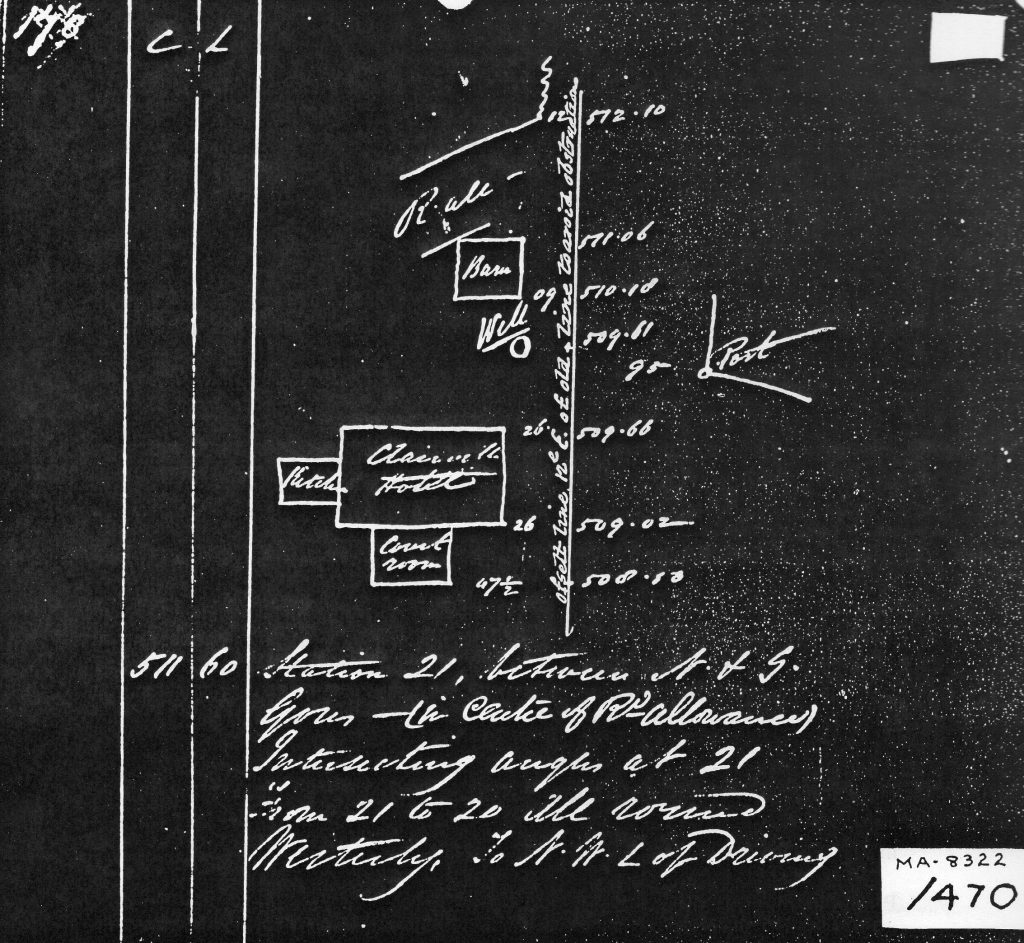
Claireville Hotel: drawing from Field Notes of Surveyors Gibson and Stoughton Dennis 1851 – copied from material in Etobicoke Public Works Department.